![Carlsbad Caverns and Guadalupe Mtns National Parks [Map Pack Bundle] (National Geographic Trails Illustrated Map)](http://miakarts.com/cdn/shop/files/71uoYWdJgdL.jpg?v=1787313524&width=760)
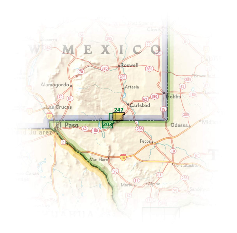
![Carlsbad Caverns and Guadalupe Mtns National Parks [Map Pack Bundle] (National Geographic Trails Illustrated Map)](http://miakarts.com/cdn/shop/files/71uoYWdJgdL.jpg?v=1787313524&width=1946)
![Carlsbad Caverns and Guadalupe Mtns National Parks [Map Pack Bundle] (National Geographic Trails Illustrated Map)](http://miakarts.com/cdn/shop/files/61TZDDojx8L.jpg?v=1787313525&width=1946)
![Carlsbad Caverns and Guadalupe Mtns National Parks [Map Pack Bundle] (National Geographic Trails Illustrated Map)](http://miakarts.com/cdn/shop/files/712vpqqWciL_adcc12ce-c079-4157-b075-f4adf106934a.jpg?v=1787313524&width=1946)
- Vendor: Mia Karts
Carlsbad Caverns and Guadalupe Mtns National Parks [Map Pack Bundle] (National Geographic Trails Illustrated Map)
Free U.S. shipping on all orders. Free international shipping on orders over $99
All orders are dispatched the next business day!
Competitive Pricing You Can Trust — Quality You Can Rely On.
ISBN: 1566959578
Author: National Geographic Maps
Condition: New
Waterproof Tear-Resistant Topographic MapsNational Geographic's Trails Illustrated Map Pack Bundle of Stanislaus National Forest provides both unmatched detail and valuable information for outdoor enthusiasts exploring California's Sierra Nevada. Expertly researched and created in partnership with local land management agencies. An informative summary of each wilderness area, safety tips, and agency contact information are included as well.Hundreds of miles of trails including portions of Pacific Crest Trail are clearly marked according to use, whether you're exploring on foot, horseback, bike, or motorized vehicle. Trail mileage between intersections will help you choose the path that's right for you. Some of the many recreation features include: snowmobile and ATV trails, ski areas, sno-parks, stables, pack stations, fishing and boat access, campgrounds, and trailheads. The map base includes contour lines and elevations for summits, passes and many lakes.The Stanislaus National Forest Map Pack includes: Map 807 :: Carson-Iceberg, Emigrant, and Mokelumne Wilderness Areas Map 808 :: Merced and Tuolumne RiversEvery Trails Illustrated map is printed on "Backcountry Tough" waterproof, tear-resistant paper. A full UTM grid is printed on the map to aid with GPS navigation. Sheet Size = 25.5" x 37.75" Folded Size = 4.25" x 9.25"
Have a question?
![Carlsbad Caverns and Guadalupe Mtns National Parks [Map Pack Bundle] (National Geographic Trails Illustrated Map)](http://miakarts.com/cdn/shop/files/71uoYWdJgdL.jpg?v=1787313524&width=1445)
![Carlsbad Caverns and Guadalupe Mtns National Parks [Map Pack Bundle] (National Geographic Trails Illustrated Map)](http://miakarts.com/cdn/shop/files/61TZDDojx8L.jpg?v=1787313525&width=1445)
![Carlsbad Caverns and Guadalupe Mtns National Parks [Map Pack Bundle] (National Geographic Trails Illustrated Map)](http://miakarts.com/cdn/shop/files/712vpqqWciL_adcc12ce-c079-4157-b075-f4adf106934a.jpg?v=1787313524&width=1445)
Carlsbad Caverns and Guadalupe Mtns National Parks [Map Pack Bundle] (National Geographic Trails Illustrated Map)
You May Also Like
More in Reference & Study