- Vendor: Mia Karts
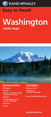
Easy To Read: Washington State Map
Free U.S. shipping on all orders. Free international shipping on orders over $99
All orders are dispatched the next business day!
Competitive Pricing You Can Trust — Quality You Can Rely On.
ISBN: 0528882104
Author: Rand McNally
Condition: New
Rand McNally\x27s Easy To Read State Folded Map is a must\-have for anyone traveling in and around Washington, offering unbeatable accuracy and reliability at a great price. Our trusted cartography shows all Interstate, U.S., state, and county highways, along with clearly indicated parks, points of interest, airports, county boundaries, and streets.The easy\-to\-use legend and detailed index make for quick and easy location of destinations. You\x27ll see why Rand McNally folded maps have been the trusted standard for years.Regularly updated, full\-color maps30% larger map with a bigger type size than the Rand McNally Folded MapClearly labeled Interstate, U.S., state, and county highwaysIndications of parks, points of interest, airports, county boundaries, and moreMileage and driving times mapDetailed indexConvenient folded sizeCoverage AreaDetailed maps of: Bellingham, Mount Rainier National Park, Olympia, Seattle\/Tacoma \x26 Vicinity, Downtown Seattle, Spokane, Vancouver, YakimaProduct DetailsDimensions (unfolded): 28\x26#34; x 40\x26#34;. 1 inch = 8.7 miles.
Have a question?
Easy To Read: Washington State Map
You May Also Like
More in Books Under $20