


- Vendor: Mia Karts
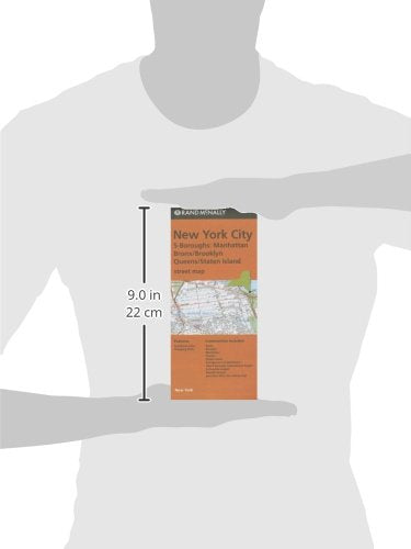
Rand McNally, New York City 5-Boroughs: Manhattan, Bronx/brooklyn, Queens/Staten Island Street Map
Free U.S. shipping on all orders. Free international shipping on orders over $99
All orders are dispatched the next business day!
Competitive Pricing You Can Trust — Quality You Can Rely On.
ISBN: 0528008587
Author: Rand McNally
Condition: New
Rand McNally's folded map for New York City 5 Boroughs: Manhattan/Bronx/Brooklyn/Queens/Staten Island is a must-have for anyone traveling in and around this part of New York, offering unbeatable accuracy and reliability at a great price. Our trusted cartography shows all Interstate, U.S., state, and county highways, along with clearly indicated parks, points of interest, airports, county boundaries, and streets. The easy-to-use legend and detailed index make for quick and easy location of destinations. You'll see why Rand McNally folded maps have been the trusted standard for years.Regularly updatedFull-color mapsClearly labeled Interstate, U.S., state, and county highwaysIndications of parks, points of interest, airports, county boundaries, shopping malls, downtown & vicinity mapsEnlargments of Manhattan, John F. Kennedy International Airport, Newark Airport and New York City vicinity mapEasy-to-use legendDetailed index & full street indexConvenient folded sizeCoverage AreaCommunities Included: Bronx, Brooklyn, Manhattan, Queens, Staten IslandProduct DetailsMeasures 9.5' x 4' and folds out to 40' x 28'.
Have a question?


Rand McNally, New York City 5-Boroughs: Manhattan, Bronx/brooklyn, Queens/Staten Island Street Map